Precision farming: lane by lane
Success
stories
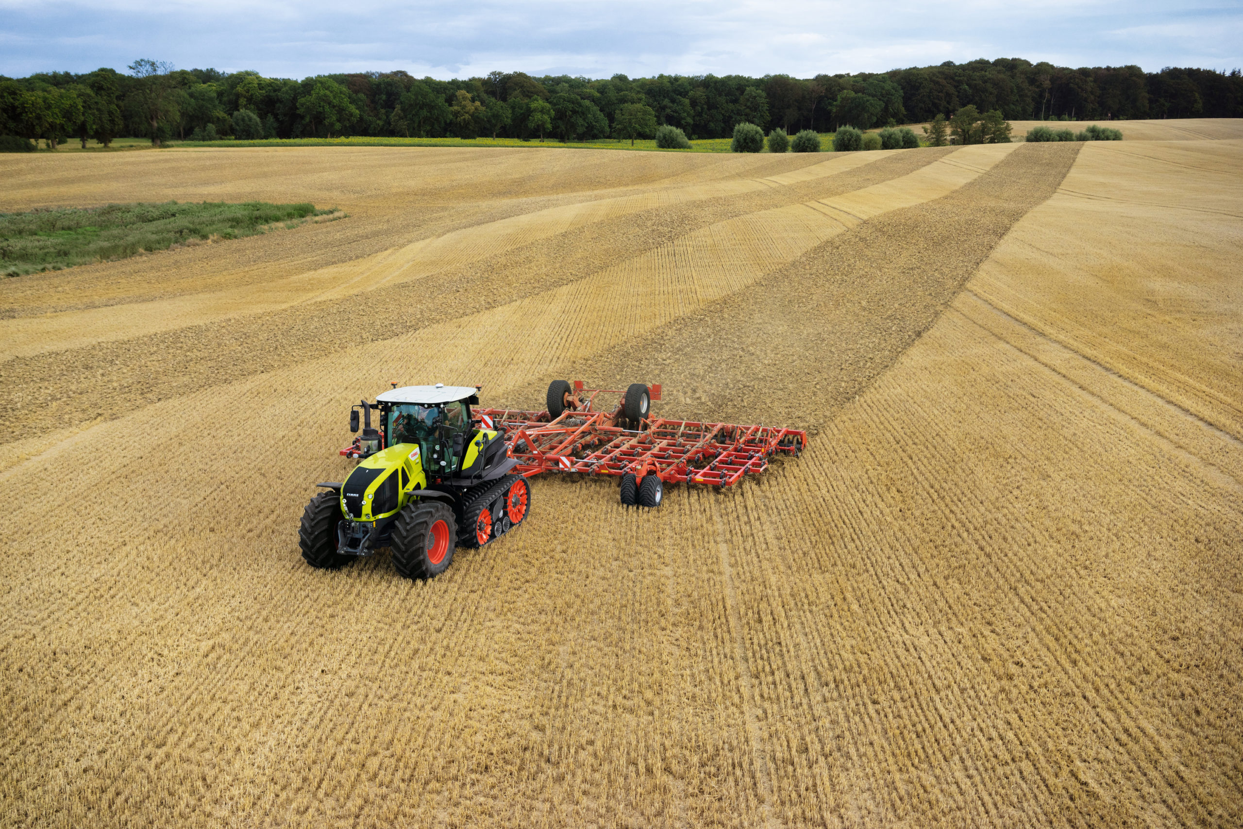
CLAAS began implementing their first autopilot system for harvesters in 1977. Technology has evolved significantly since then, as well as the need to save resources like fertiliser or seeds, time, and money. Automated steering systems are state of the art technology heading towards fully autonomous machinery.
Quick amortisation
On average farmers save up to 5% of their costs due to high precision steering on decimetre level (± 30 cm). It doesn’t sound like much at first, but keep in mind that these are constant savings, hectare by hectare and year by year. Usually, investment in the technology is equalised after two years. Modularised services from GNSS positioning to RTK-solutions (up to ± 3 cm accuracy) can be offered, depending on the correction signal and/or service chosen.
A multi-device system
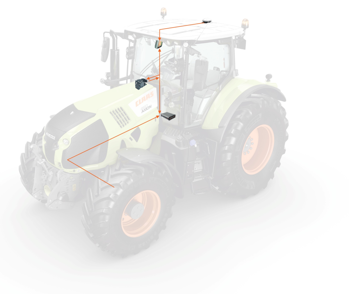
Harvesters and tractors are actually high-tech systems consisting of several devices, sensors and controllers. The basis is still the chassis and engine. In addition, a high precision GNSS antenna is mounted on the roof of the machine. Usually, it’s connected with a screen-based terminal as well as a navigation controller. This controller hosts a 6-axis gyroscope to help calculate the lanes precisely. The output is steering commands. They can either be implemented by an electronic wheel if no proportional valve exists. If it exists, commands control the valve directly. All this results in adjusting the proportional valve and makes accurate steering possible.
It all starts with GNSS
The basis for precision farming is the positioning, ideally on a centimetre level. CLAAS’s controller is capable of handling GPS, GLONASS and Galileo. For operation, at least 5 satellites have to be available. More satellites ensure a higher robustness against shielding by trees, bushes or buildings. Dealing with centimetre accuracy also means that the device the machine is equipped with matters. Usually, machines for pesticides are about 27 meters wide or even bigger, but ploughs can be much smaller. To enable automated lane-based steering, the controller needs to calculate the routes based on the terminal input and additional information, i.e. which add-on is being used on which machine, on which position the antenna is mounted, and what the task is to be performed. And of course, we don’t live on a flat earth, the terrain and curves are taken into the calculation as well.
A connected world
The position is crucial for application and harvest. During harvest, sensors such as infrared cameras can measure the yield. Combined with the position a map of yield can be created. An application map which is created on remote sensing data controls the number of seeds, fertiliser and pesticides spread on the field. Special control settings allow variable rate control or section control, to avoid double spread.
Contact: claas.com
Galileo for robustness
Galileo enables higher robustness of GNSS signals against shielding in multi-GNSS applications. In addition, with license-free EGNOS correction service, lane-by-lane farming is possible out of the box. Moreover, Galileo signals can be improved by RTK mobile stations as well as services via the cellular network.