Shyn – Revolutionising seamless outdoor-indoor positioning market
Website
http://epic.blueFounders
Michael IllsbrouxGeert Claeys
Frederik Malesevic
HQ
Leuven, BelgiumMilestones and Achievements
Founded: 2016
Awards: 2018 Airbus Critical App Competition winner
2019 EDA Defence Innovation Prize winner
First responders are usually the first to face dangerous, challenging, and draining situations. It’s estimated that 30% of first responders develop behavioural health problems such as posttraumatic stress disorder (PTSD), in addition to having higher suicide rates1. Any new solution that reduces the side effects of a job as important as that of first responders is welcomed. Epic Blue wants to lessen the stress on first responders with their highly reliable location tracking IoT wearable. Shyn’s tracking solution operates both indoors and out, combining IoT insights with location data to provide accurate information on first responders, no matter the circumstances.
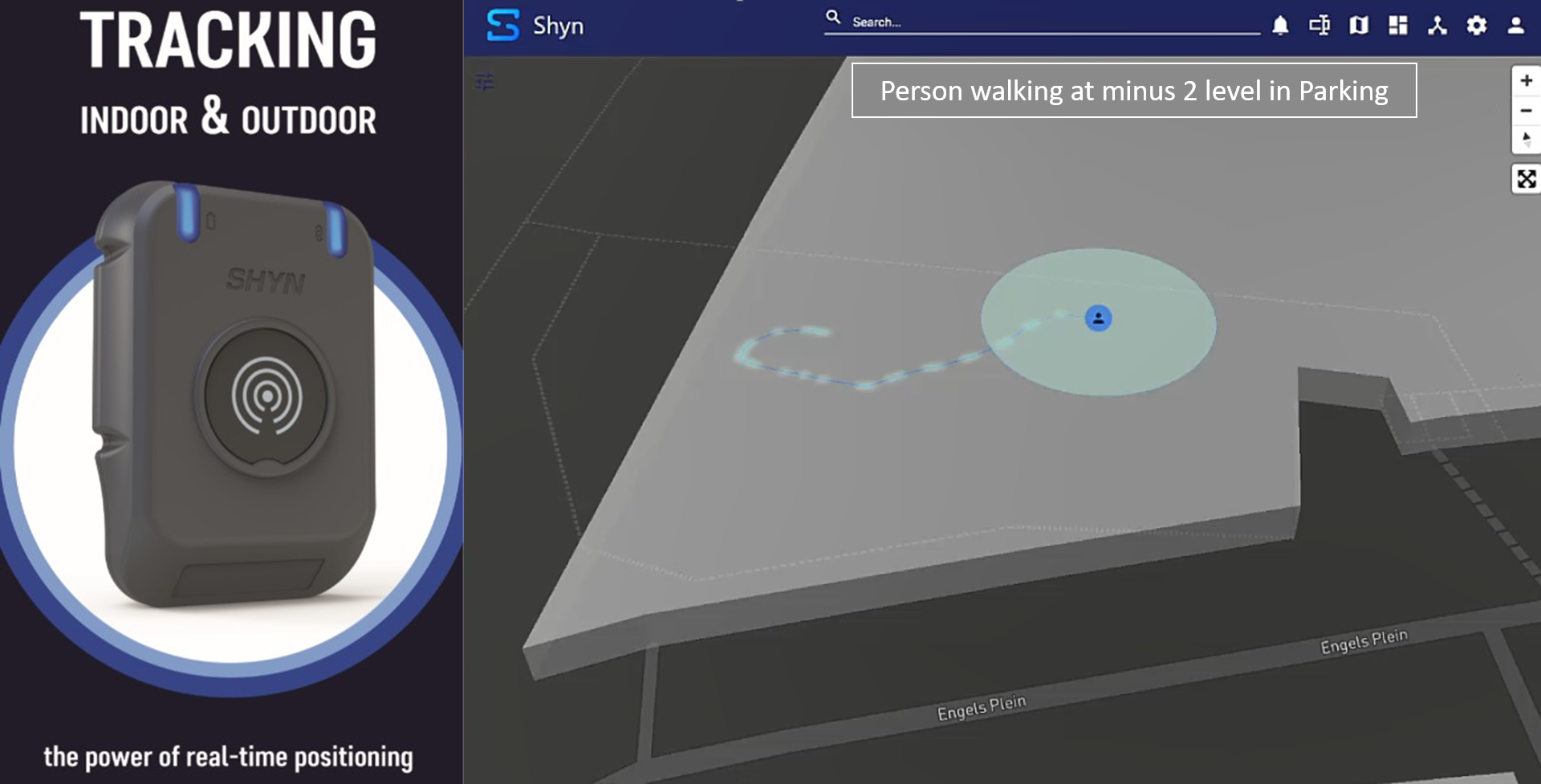
Shyn is unique in that it works in both GNSS and GNSS-denied environments. Using Galileo data as the foundation, inertial measurement (IMU) data and navigation beacons are combined using an AI engine. In underground places such as canyons and tunnels where there is no GNSS data available, the AI engine can still model human movement and changes in a person’s position. This increases the wearer’s safety in unexpected critical situations. Shyn also connects to other IoT devices through Bluetooth, allowing for parameters such as hazardous materials to be included. The wearable is IP67 dust and water resistant, has a panic button, and can detect if its wearer has fallen.
Epic Blue is passionate about improving the safety, security, and effectiveness of field teams. This issue is personal to the founders, who came up with the idea after receiving feedback from firefighters they personally knew. Since its inception in 2016, Epic Blue has won the 2018 Airbus Critical App Competition and was ranked one of the EUtop50 start-ups. The team has a total of 75 years of experience between them in leveraging geospatial and location data for critical situations. Their goal is to provide complete location coverage anywhere in the world, so that everyone can return safely to their families at the end of the day.