Aerial Tools – Map & monitor the world with next generation drones
Website
http://www.aerialtools.comFounders
Pablo Miguel Martínez SanchezVerónica Sobejano Paz
Panagiotis Karachailos
HQ
Copenhagen, DenmarkMilestones and Achievements
Founded: 2019
Awards: DTU Skylab Ignite 2019
Beyond Beta Accelerator 2021
+Impact Accelerator 2021
CSE Incubator Proof Programme 2021
Sustainary Green Crowdfunding Accelerator 2021
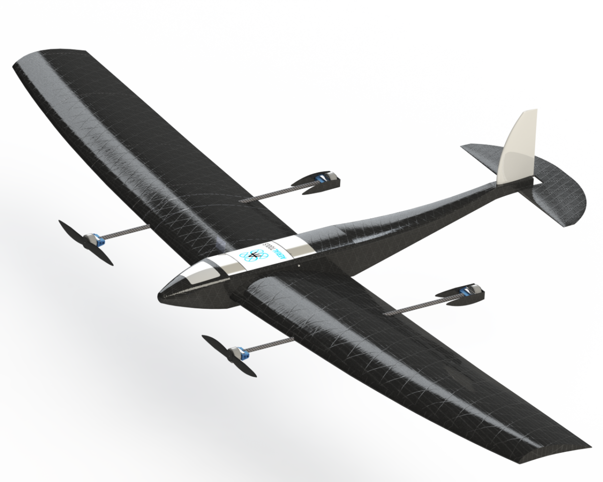
Gathering data from a bird’s-eye view offers valuable information due to the speed and accuracy with which it can be collected. The drone market is dominated by multi-rotor drones with Vertical Take-Off and Landing (VTOL) technology. These drones are easy to pilot and most favoured in the market. But the main flaw with VTOL lies in its power-consuming hovering technology. Aerial Tools, a Danish start-up, aims to improve efficiencies around gathering aerial data. Their hybrid drone design takes advantage of VTOL technology, but at the same time, enables easy transition from hovering to forward flight. This optimisation increases flight time and reduces overall power consumption. Aerial Tools’ VTOL drone is designed to be used for mapping, agricultural monitoring, and infrastructure inspection.
The VTOL drone is smartly designed to expand upon the current sensing capabilities of drones by integrating a wide range of applications and sensors. Global Navigation Satellite System (GNSS) data and IoT is fundamental in the development of their new, higher efficiency VTOL technology and modular payload system. For instance, Aerial Tools’ drones can incorporate new sensors, cameras, and machine learning tools, facilitating its adoption to niche markets.
Apart from the hybrid VTOL technology that increases flight time by up to four hours, the payload is designed to facilitate the integration of sensors in a plug-and-play concept. Their plug-and-play technology allows drones to easily connect with the flight controller without any need for a time-consuming installation. Aerial tools provide their clients with much more than just a product. They will also swap out out-of-date parts, customise drones to personal needs, and will ensure the latest updates are always available. Their drones will never be outdated.

The idea for Aerial Tools was born in 2018 when Verónica started her PhD in Remote sensing with a focus on the agriculture industry. One of her tasks was to develop a machine learning algorithm to optimise in-field fertilisation and watering needs. During her search for a suitable drone, Verónica realised that the specific drone she was looking for was uncommon and extremely expensive. As a result, she reached out to two of her engineering colleagues to develop a solution, and they founded the company in 2019. They have already shown proof of concept and are patent pending. The team at Aerial Tools aims to improve aerial data acquisition in B2B commercial inspections and monitoring by offering a solution that is remotely accessible and uses less power than standard drones.